Urban planning situation and public space
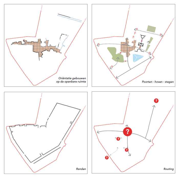
Orientation of buildings with regard to the public space
Many buildings are oriented with their backs towards the important connecting public space (blue dotted line). The continuous black line shows the (parts of) buildings that face the public space (pink hatching).
Gates – courtyards – alleys
The organically grown sequence of gates (gate symbol), courtyards (green and blue) and alleys (dotted arrows) is still partially visible in the superblock. The later addition of the pyramid-shaped University cafeteria violated the structure of open courtyards. The secluded nature of the central public space (in pink hatching) was lost.
Edges
The hard edges of the area consist of buildings along Kloveniersburgwal, Oude Turfmarkt/Amstel and Nieuwe Doelenstraat. Their plots are perpendicular to the streets. The 19th-century buildings along Grimburgwal are large and free-standing.
Routing
The conglomerate of buildings and outdoor spaces lacks a clear routing, and the UvA does not have an entrance on Slijkstraat.
See the urban planning situation and public space in chapter 5 (pp. 48-55 in Dutch)